At the Duke Forest, researchers use drones as full-scale scientific instruments rather than simple aerial cameras. The forest provides a controlled outdoor environment where engineers and environmental scientists can test systems in conditions that closely match real deployment challenges.
The work is led in part by teams from Duke University, especially the Marine Robotics and Remote Sensing Lab. Their focus centers on collecting environmental data in areas that are difficult or impossible to study from the ground. Drones let them capture high-resolution information from forest canopies, terrain features, and wildlife habitats.
High-Payload Drones Enable Advanced Sensing
Researchers rely on a heavy-duty drone platform called the DJI Matrice 350 RTK, nicknamed “Bowser.” The system carries multiple sensors at once, including LiDAR, thermal cameras, and optical imaging tools.
This flexibility allows the same drone to map terrain, analyze vegetation structure, and detect temperature differences during a single field session. Instead of switching platforms, researchers switch sensor payloads depending on the research goal.
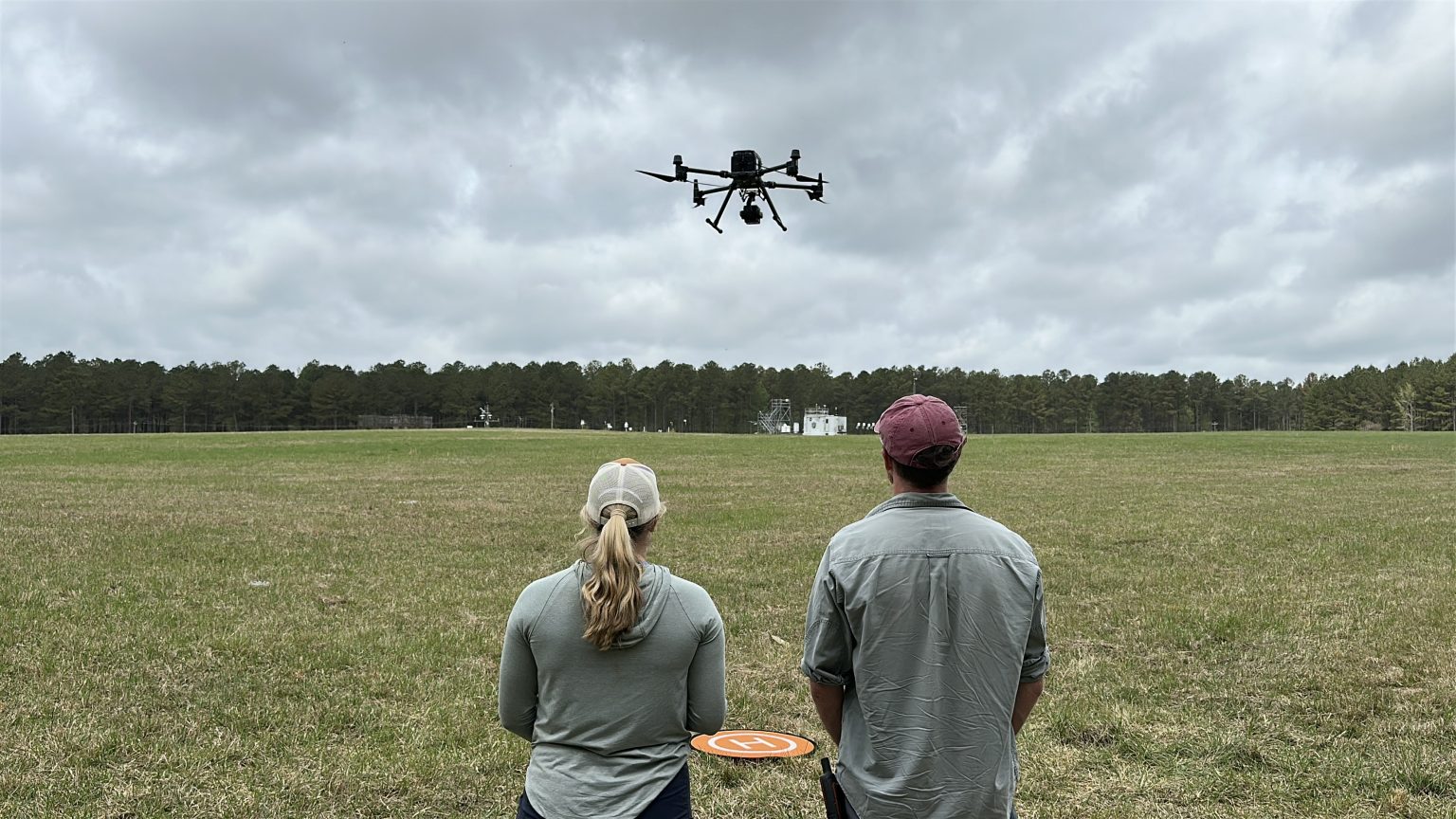
Field Training Improves Data Quality
Before teams travel to international field sites, students and technicians train in Duke Forest to build flight experience and validate equipment. They log structured flight hours and practice maneuvers like precise navigation patterns and controlled flight paths.
This training directly improves data quality. When operators understand how the drone behaves in wind, tree cover, and variable lighting, they collect more consistent and reliable measurements during real research missions.
Environmental Research Applications
One major project uses LiDAR scans of forest canopies in Thailand to study how elephants change forest structure over time. Researchers compare new drone-based scans with satellite data collected over the past two decades to measure long-term environmental impact with higher precision.
Another project applies thermal imaging to monitor white-tailed deer populations in Duke Forest. Instead of relying only on traditional survey methods, researchers now combine ground-based counts with aerial thermal data to improve accuracy and reduce manual effort.
Multi-Drone Autonomy Research
The General Robotics Lab at Duke University focuses on multi-drone autonomy. The team develops systems that allow multiple drones to coordinate in complex outdoor environments without constant human control.
These systems target real-world applications such as search and rescue, disaster response, and rural logistics. Instead of treating drones as individually controlled tools, the research pushes toward coordinated robotic teams that can share tasks and adapt in real time.
Why Duke Forest Matters for Robotics
Duke Forest works as a practical testing ground because it combines open areas with dense canopy cover. That mix forces drone systems to deal with realistic navigation and sensing challenges rather than simplified lab conditions.
As drone technology advances, researchers use this environment to bridge the gap between experimental robotics and deployable systems. The goal is to move from controlled demonstrations to tools that operate reliably in the real world.
Vraj Parikh